January 6, 2021 - Sharon: Moose Hill Sanctuary
Welcome to Susan's Bay Circuit Diary! This blog follows my adventures with my dog Sulu hiking the Bay Circuit Trail. To get new posts in your inbox, please subscribe (see the little "subscribe" oval above). The rest of the past posts can be found using the little menu on the left. If you are curious how this all started, go here.
Because I'm always a bit behind documenting my adventures on the trail, I thought I would do a 2020 recap now. I made 59 trips, a few of which Sulu was excluded from. I've covered about 123 miles (I finally figured out how to use the trail guide to count mileage on the trail) of the trail - more than half the 230 mile length. Walter reminds me that I've walked almost double 123 miles, from the start to the end and back again. So that's something!
 |
| From H to G, then H to the red asterisk |
Today's walk was a "cleanup" trip: we leaped over the Moose Hill segment last month since the Audubon property does not allow dogs. Sulu had an appointment at the groomer's today, so today was the perfect day for this walk.
Once more, I spent some planning time at home so I wouldn’t have to refer to the phone for navigation during my walk to conserve battery time. I’ve been getting back to the car with 2% battery life remaining pretty consistently. It took me a few minutes to reconcile the BTC map with the map on Audubon’s Moose Hill website. Why? The Moose Hill map was drawn upside down! Really?
I’m listening to an engrossing audiobook now and today is the day I hope to finish The Subtle Knife, the second book in the His Dark Materials trilogy by Philip Pullman. The audiobook is a full cast reading with the author narrating and I have been enjoying it so much, but without dog agility classes my big chunks of time in the car are limited.

The parking lot at Moose Hill is in the middle of the property, with one arm of the trail to the east and one arm to the west. I chose the opposite direction from the other couple setting out at the same time as me.
The Audubon trails are really well marked and the BCT is also clearly signed.
The bright sun shining off the moisture on the fallen leaves made the trail appear silver. I saw few signs of animal life, but heard one or two chickadees calling.
After so much time walking on the flat, the climb up Hobbs Hill, although not impressive to anyone, feels like work. The top of the hill features no view.
 |
| Hill |
On this winter day, most of the green that’s not a pine tree is a moss or a lichen.

As I approached the road which marks the boundary of the sanctuary, the woods opened up into a plantation of mature pine trees which meant I could see quite a ways all around me except for the tall straight trunks.

I chose to complete the Hobbs Hill loop rather than returning the way I came. I was hoping for a flatter route, but it’s also shorter on the map and there’s no rule saying I have to actually do everything twice.
 |
| First I was jealous that there was a dog here, but look at the prints! They are little hands, so I think "raccoon". |
On the return loop, I passed three people in quick succession, two out of three of whom were wearing masks, but all being very respectful of my social distance.
The wet leaves are quite slippery so I have to be careful and slow going downhill.
In search of a faster route, I decided to take a right rather than a left coming off the Hobbs Hill loop for a little road walking on a country road, a quicker route back to the car and the start of the second part of the trail.
Back at the car, I had a water and Kleenex break and an unpleasant argument with a man about my electric car. As he walked by my car, he was mansplaining to his wife about how electric cars are responsible for more carbon than gas cars. Au contraire, yahoo. I hate to argue, but I hate b***s*** more. Naturally there was no winning the argument, with his parting words to me that I was choosing to sit on the back of the Titanic.
The trails throughout the sanctuary are a mix of carriage roads and rooty narrower trails. They advertise cross country skiing here and some of the trails look like they would be ideal.
 |
| Picture more snow and skiing here |
Today was to be a two hill day, with the second hill being higher than the first, although the name Summit Trail is perhaps a bit of an exaggeration. At the top is an inaccessible fire tower. There was no vista on top of the hill by the fire tower, but road noise.

 |
| View from Bluff Head |
 |
| View from Allen's Ledge |
 |
| These beech or chestnut are the last to lose their leaves and the rustling sound is unexpected |
 |
| The turnaround point |
Once more I chose a different and hopefully shorter route to return.
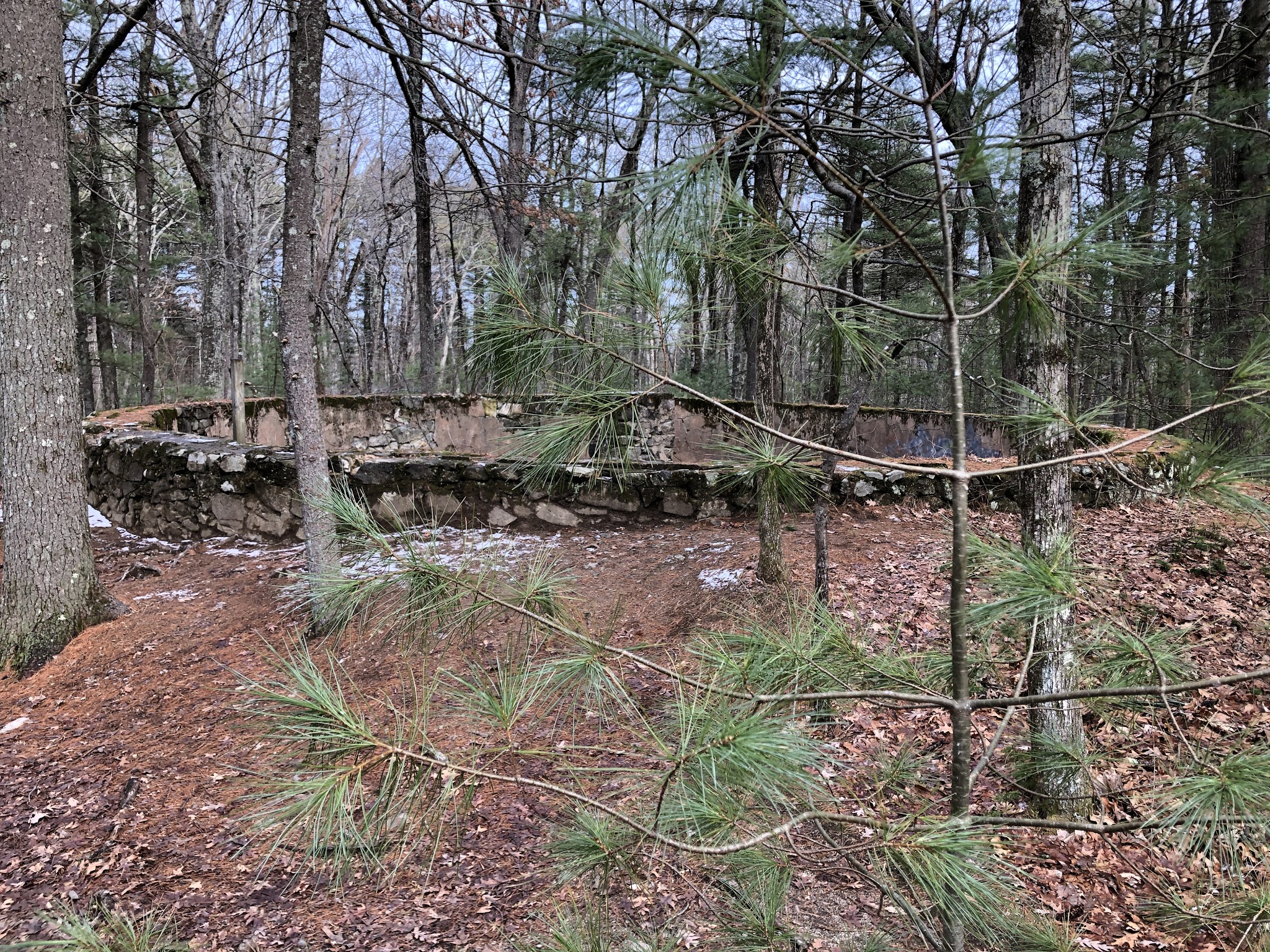 |
| I would never have seen this cool round cistern had I stuck to the BCT 100% |
 |
| I saw these turkey rocks on my way out, and finally the sign alerting me to their presence |
 |
| Gratuitous princess pine picture |


Comments
Post a Comment