January 11, 2021 - Easton to West Bridgewater: Hockomock Swamp
Welcome to Susan's Bay Circuit Diary! This blog follows my adventures with my dog Sulu hiking the Bay Circuit Trail. To get new posts in your inbox, please subscribe (see the little "subscribe" oval above). The rest of the past posts can be found using the little menu on the left. If you are curious how this all started, go here.
Today’s trip took a sort of T shape: I parked at the Hockomock Swamp Wildlife Management Area in West Bridgewater and walked back toward Route 138 in Easton where we last left off. Then I went onward into West Bridgewater.
 |
| Entrance to the conservation area. This gate is described as "orange" in the guide. |
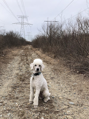
Hockomock WMA is posted on leash only but I did let him off leash once we got to the power line. I continue to have some vague rationale that if a property is open to hunting, then off leash dogs should be allowed too. How is Sulu supposed to retrieve the pheasant on leash?
The Hockomock Swamp, at over 16,000 acres is the largest vegetated freshwater wetland system in Massachusetts. Over 5,000 acres of it are in conservation. It was a valuable resource to the Wampanoag people. It also has an interesting reputation for the supernatural and unexplainable. Local paranormal enthusiasts refer to it as the “Bridgewater Triangle”.
As usual, I enjoyed the relative privacy of the power cut even though there was evidence of the built environment everywhere. Sulu kept flushing the same flock of juncos (link) as we walked on the dirt road. The temperature was in the low 30s but it felt warmer.
 |
| Mr. Freshly Coiffed |
I’m was really appreciating the subtle color contrast of the green briars with some red twig shrubs, and then the yellowish tan of the reeds.
There was lots of road noise today from busy Route138 and what I believed was Route 24 on my right.
 |
| Oops. |
I got to the end of the pole line and my route to the road was interrupted by a big marsh pond, with no sign of an onward trail. I realized, oops I made a mistake, but after fussing with the paper map and guide I had to take out my phone and look at AllTrails to work it out. I basically turned left instead of right when I got to the power cut so I needed to reverse my track. What I took to be “ busy 138” was actually route 24. These are the perils of trying to follow the BCT directions backwards where rights are left and lefts are rights. I went a little more than two miles needlessly.
 |
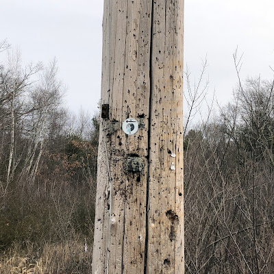
| It's awkward to explain why I interpreted this sign as "go right". |
 |
| Turnaround at Route 138 |
Once back on the trail, I started seeing a lot of trash on the trail.Is it the hunters? I have a bag (of course) so decided to pick some of it up. Six water bottles and three beer cans later, I was back at the car, where I took a little break to charge my phone and let Sulu drink.
 |
| I did meet this cool new-to-me plant. Related to the princess pine? |
Starting again from the parking lot it’s road walking. After leaving the dirt road that is Maple Street we start on one of the least glamorous parts of the BCT we have yet to encounter. There are places where they’re mysteriously accumulating giant mountains of dirt. There’s a new YouStore facility coming soon, Route 24 in the background… I’m surprised there’s not a dog agility place somewhere around here.
This section is not particularly well blazed either. The two turns after leaving Hockomock were not marked at all. But we’re crossing Route 24! After this there’s only one more major route to cross, Route 3 but I don’t think we’ll see that for a while.
 |
| Route 24 above |
It looks like they are be building a huge housing development back behind Scotland Street. There’s a ton of heavy equipment and what appeared to be a few rights of way where all kind of work is going on and big vehicles are coming out. So much trash by the road, illegal dumping and dog poop. Basically my impression of West Bridgewater so far is earth desecration and right wing working class. I parked the car at the beginning of a real trail which I look forward to taking.
As of my last walk, I've finished both Map 10 and Map 11! That means only three more maps to complete the southern part of the trail.


Comments
Post a Comment