January 15, 2021 - West Bridgewater
Welcome to Susan's Bay Circuit Diary! This blog follows my adventures with my dog Sulu hiking the Bay Circuit Trail. To get new posts in your inbox, please subscribe (see the little "subscribe" oval above). The rest of the past posts can be found using the little menu on the left. If you are curious how this all started, go here.
 |
| From the red asterisk to the P at Reynolds Landing |
 |
| Born to run |

“The historical Nunckatessett River, known today as Town River, originates in the largest freshwater wetland system in Massachusetts, the Hockomock Swamp, a protected area of Critical Environmental Concern. The 12 mile Town River corridor is one of the earliest areas of colonial settlement with the first church built in 1651, and the very first inland sawmill and grist mill founded in 1654. The Town and Matfield Rivers converge to form the Wild and Scenic Taunton River, federally protected under the National Park Service.” - Nunckatessett Greenway website
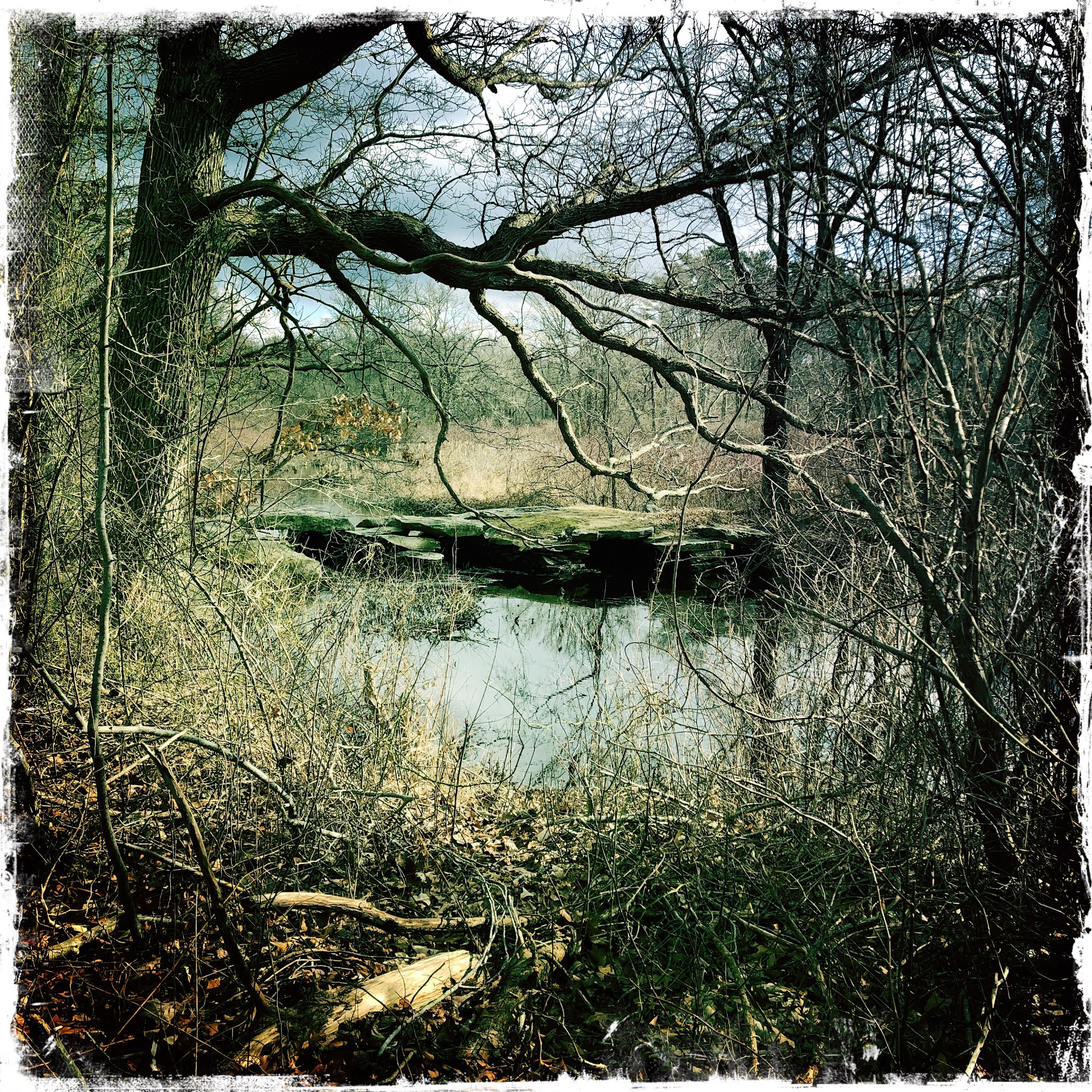 |
| Skim Milk Bridge |
One especially charming feature of this .6 trail segment is the Skim Milk Bridge. This website describes it as “dry stone constructed”, but that sells it short. It’s constructed from slabs of stone. It reminds me of a clapper bridge we saw in Dartmoor in the UK:
 |
| By User:SeanMcTex - Own work, Public Domain, https://commons.wikimedia.org/w/index.php?curid=269375 |
We came off the trail through a suburban backyard, as stated in the guide, and set off onto Forest Street, a newly paved road with the Hockomock on one side and sparsely settled with houses on the other.

Soon after leaving the woods we came upon the so-called Solitude Stone. I stared and stared at the stone but could not see any writing. Has the stone worn? Was the lighting bad? Am I old? It’s a mystery.
 |
| No picture of the actual stone since I didn't realize what it was until I got home and looked it up. |
Although there was no sidewalk on Forest Street there’s very little traffic and it was an easy road walk.
Despite his shaved ears and tail Sulu is easily recognizable as a poodle. A man I passed working on his car said “I haven’t seen one of those in years.”
This section of the trail is sparsely blazed, but there are marks in key places.
Forest Street turned out to be favorable for seeing birds. I saw a bluebird fly out of someone’s yard onto a telephone wire. That’s a change from the chickadees that I’m accustomed to seeing on the trail. On the way back, I noticed a lot of bird activity by the Town River on Forest Street. I’m terrible at identifying bird calls but they were at least three different species, all non-chickadees. I also a saw a small woodpecker.
It was both sunnier and warmer than I expected today. I wasn’t wearing a middle layer, and wore a baseball cap instead of a warm hat.
 |
1662 Rev. James Keith House |
 |
| Canoe Club |
There is also a legacy agricultural district with cattle, goats, and chickens. On my way home in the car I stopped by and bought some eggs, and said hi to the steer.

 |
| A Little Free Library (Ash Street) reassures me that my kind of people live here |
 |
| An Eagle Scout project is in process here and they may be responsible for the shiny new sign |
 |
| Larry and Ted. Or possibly Ted and Larry (sorry, guys) |
I took a couple of minutes on my return trip to explore the War Memorial Park in West Bridgewater on my way back. Although there are war memorials, much of the park is devoted to historic industry in the town. The water flow through the park is incredibly complicated. I think there’s a fish ladder for the herring in there but I couldn’t identify it.
 |
| Supposed to be an outstanding feature of the park but congested with debris |
 |
| Part of a divided spillway |


 |
| The Town River at Forest Street |
 |
| Now that I'm a connoisseur of split levels... this is a "side split", where the split is not visible from the front |
 |
| This old guy was in his paddock on my way back |
I think I surprised a grebe on the wooded trail trail back to the car. At first I couldn’t figure out if it was a bird or a mammal in the water. It was quite shy, zigzagging across the river. I startled it three times from one section of river to the next. It didn’t have a duck profile; the neck was longer and with the head had sort of a little white cresty thing. Then the river bent away from the berm that the trail is on and I couldn’t follow it anymore. Naturally it didn’t match any grebe in the book, but I’m pretty confident about the silhouette.


So last friday we hiked BCT from 13A to maps 13H, the trail description shows a gap between G and H so at the last BCT marker we could find we turned left and headed to rt 27 and then right on 27 to get back to the trail. Don't do that! That trail was under water much of the way resulting in bushwacking and wet feet. Later we found that we could have continued straight onto a trail which is not marked, it turns right then then left and pretty quickly comes to 13H. Maybe 1/2 mile. Why this is not marked or mentioned or at least shown as a thin red line on the map is yet another BCT mystery. Have fun on the trail.
ReplyDeleteI'm so jealous that you have two cars and go so fast! Was that your RAV4 I parked next to at the substation? I made it up to D+ myself (not yet published). I will look closely at that G-H segment. When I saw the decrepit factory at the site of the cotton gin I thought of you - old machinery galore!
ReplyDeleteThe Rav4 belongs to Larry, the Chevy bolt you saw at the canoe launch is mine.
ReplyDeleteMore on the gap is written up at shorthike.blogspot.com
ReplyDelete