January 25, 2021 - East Bridgewater to Hanson
Welcome to Susan's Bay Circuit Diary! This blog follows my adventures with my dog Sulu hiking the Bay Circuit Trail. To get new posts in your inbox, please subscribe (see the little "subscribe" oval above). The rest of the past posts can be found using the little menu on the left. If you are curious how this all started, go here.
 |
| From letter E to letter H |
This journey began with a thrill: Google directed me to Route 3 to begin my walk! Route 3 is the last major route on the trek to Duxbury and the southern terminus of the BTC. Today is also the longest travel time I’ve had to a trailhead: nearly an hour.

Parking at the entrance to a drinking water treatment plant, Sulu and I headed back along the road to where we turned around last time. The day was cold (29 degrees F) and clear. Noteworthy on our walk were the large numbers of residential solar panels, and the second lawn jockey in East Bridgewater, only the third for the whole trail. We were back at the car in under an hour.


The trail then led us past the water treatment facility and to a high voltage power line. There was quite the blue jay convention going on along the access road.

Sulu has advanced to having his picture taken in a standing position - a training triumph (the out of focus part is my responsibility). There was some uncertainty picking up the trail at the power line. I didn’t see any blazes along the line of wooden poles running perpendicular to the high voltage line. I turned around and resorted to AllTrails (thank you new battery), which directed me back to where I came from. The printed BCT map was not helpful, but I backtracked to where we came in, I re-read the directions, used my compass app to find East as mentioned in the directions, and found the trail! The area is called the Smith-Nawazelski Conservation Area.

We were immediately on a beautiful boardwalk going over the Poor Meadow Brook. Let me revise that - the boardwalk started off well but has clearly seen better days. We trod carefully and never had to walk in the marsh.

After the boardwalk the trail led into some woods alongside the Poor Meadow Brook. I did my best to follow though there were zero blazes. I came to the medium voltage pole line mentioned in the directions and I headed uphill following the line. I finally saw a random blaze on a random tree off to the side. I’ve seen three tree stands since leaving the water filtration place so this is obviously a popular deer hunting area.

At some point we crossed from East Bridgewater into Hanson. We crossed a road into the Burrage Pond Wildlife Management Area. Burrage Pond WMA is a former cranberry property that is being allowed to revert into a natural white cedar and red maple swamp. I couldn’t find information about it online, but I assume it was carved out from the Hockomock years ago. It's a beautiful property and has many trails and ponds - it would be great for some cycling in warmer weather. It's supposed to be a great birding spot in season, too.

Unlike East Bridgewater, Hanson seems fairly serious about their dog rules. I must’ve passed four signs reminding me to keep my dog on leash in this wildlife management area. And I saw another walker with his dog on leash as well.
 |
| You can't read the fine print, but hunting dogs are only allowed off lead "to hunt, train, or participate in field trials" with a licensed hunter. They have more lenient poop-pickup rules. |
 |
| Native holly |
We must be in a biome closer to that of Cape Cod. For the first time I was seeing wild holly plants. There was actually a surprising amount of non-pine evergreens. Not just hollies, but carpets of teaberry, laurel, princess pine, deeproot clubmoss, and big stands of inkberry.
 |
| Teaberry and deeproot clubmoss |
 |
| Inkberry |
This is a lovely trail but I would enjoy it more if my dog could be off leash.
Sulu was not at all sniffy until we got about halfway through the off leash part of our walk and now in this WMA he’s very attentive to the possibility of lady coyotes.
The trail left the woods and became a berm flanked by extensive marshes on both sides. These are former reservoirs for the cranberry farm that are reverting into marsh.
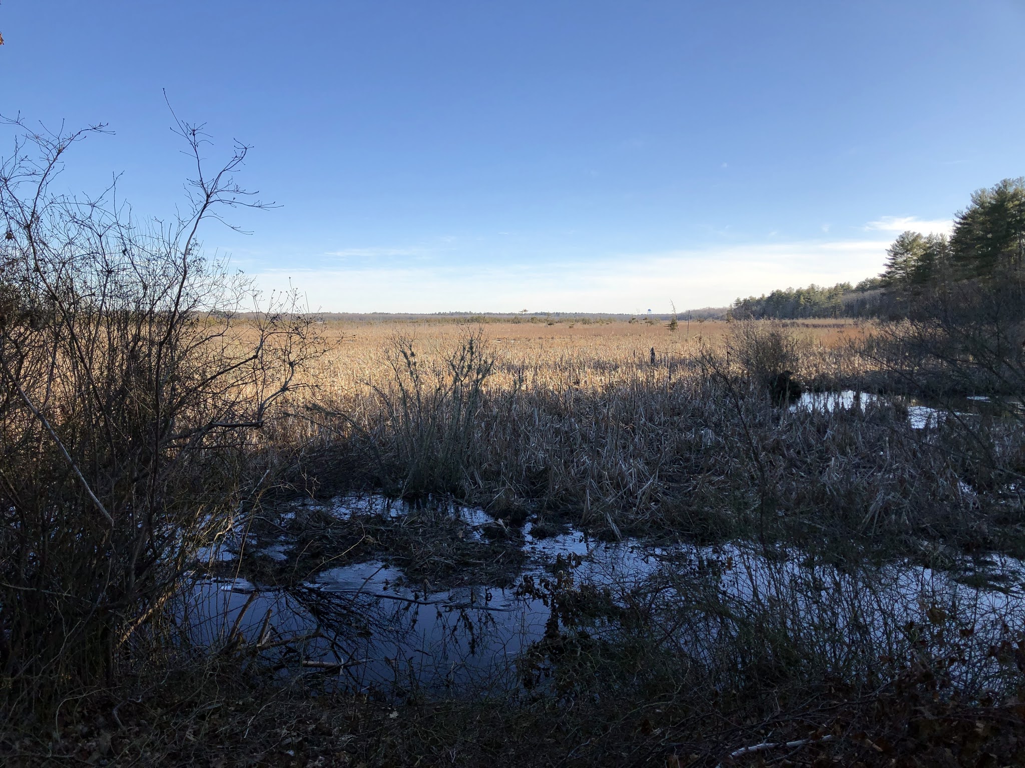
This berm is supposed to be an old Indian trail but Europeans have had their paws all over this landscape for 400 years so who really knows.
We emerged from the marsh into a woods, reassured by the BCT blaze that I am on the trail.

We turned around at the railroad crossing (in use at the time).

Total: 8.2 miles.


Comments
Post a Comment